Welcome to ALTA Survey North Carolina

Your Final Stop for Your ALTA Survey Needs!                              Contact us today for a free quote!

This site is intended to provide you with information on ALTA Surveying in North Carolina. If you’re looking for a North Carolina Land Surveyor, you’ve come to the right place. If you’d rather talk to someone about your land surveying needs, please call our toll-free number at (888) 808-9783 today. For more information, please continue to read.

ALTA Survey North Carolina

Land Surveyors are professionals who make precise measurements to determine the size and boundaries of a piece of real estate.  While this is a simplistic definition, boundary surveying is one of the most common types of surveying related to home and land owners. If you fall into the following categories, please click on the appropriate link for more information on that subject:

ALTA Survey North Carolina services:

    1. I need to know where my property corners or property lines are. (Boundary Survey)
    2. I have a loan closing or re-finance coming up on my commercial property. (ALTA Survey)
    3. I need a map of my property with contour lines to show elevation differences for my architect or engineer. (Topo Survey – ALTA Survey plus Table A Item 5.)
    4. I’ve just been told I’m in a flood zone or I’ve been told I need an elevation certificate in order to obtain flood insurance or prove I don’t need it. (Flood Survey)
    5. I’m purchasing a lot/property for a commercial use. (ALTA Survey – Item 5 and/or Item 11b may also need to be discussed.)
    6. I’m purchasing a larger tract of land, acreage, that hasn’t been subdivided in the past. (Boundary Survey)
author avatar
Surveyor

More Posts

Homebuyers signing real estate documents with house models and keys on the table, representing the importance of an elevation certificate for property closings
flood damage
Surveyor

How a Missing Elevation Certificate Can Stop Your Sale

If you’re buying or selling property near the coast right now, there’s one document that could make or break your deal — the elevation certificate. In the middle of new storm damage, shifting dunes, and FEMA’s budget delays, this simple survey report has suddenly become one of the most important

Read More »
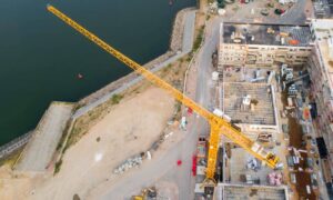
Aerial view of a commercial construction site with a yellow crane, showing land boundaries and layout preparation for an ALTA Title Survey
alta survey
Surveyor

Before You Build: Why an ALTA Title Survey Comes First

Charlotte’s skyline is changing fast, and nowhere is that more visible than in SouthPark. The city’s favorite shopping and business district is getting ready for a big transformation. Just this month, Hines announced plans for a 275-foot mixed-use tower near Sharon Road and Carnegie Boulevard, right across from SouthPark Mall.

Read More »
Aerial view of seaside homes near a steep eroding cliff showing how shifting coastlines can affect a flood elevation certificate
flood damage
Surveyor

Is Your Flood Elevation Certificate Still Accurate?

When videos of houses falling into the ocean in North Carolina’s Outer Banks appeared on the news, it shocked everyone. The scenes showed homes breaking apart and sliding into the surf after days of strong waves and king tides. For people living near Wilmington—especially in Wrightsville Beach, Carolina Beach, and

Read More »
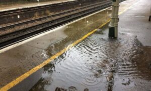
Flooded train station platform showing poor drainage design and safety risks after heavy rain.
civil engineering
Surveyor

Why Drainage Design Is Critical for Public Safety

When the North Carolina State Auditor released a new report on Charlotte’s light-rail system, most of the headlines focused on security and crime. The audit came after a high-profile incident on the Blue Line, and the story spread quickly across local news and social media. But if you read between

Read More »
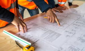
Surveyors reviewing construction survey plans to ensure stormwater compliance and site plan approval
construction
Surveyor

Why a Construction Survey Matters for Site Plan Approvals

If you are planning new development, one thing can decide whether your project moves forward or stalls: the construction survey. In the past, site plans often hit roadblocks over traffic or zoning. Today, stormwater has become the true gatekeeper. County boards, engineers, and neighbors now want proof that your site

Read More »
Licensed surveyor operating a drone for drone surveying in an outdoor land surveying site.
land surveying
Surveyor

Managing Risks and Challenges in Drone Surveying Today

Drone surveying is changing the way land surveys get done. It’s faster, safer, and can reach places that are tough to access on foot. But, like any new technology, drone surveying comes with its own set of challenges. Real surveyors on Reddit have shared stories that reveal the risks and

Read More »