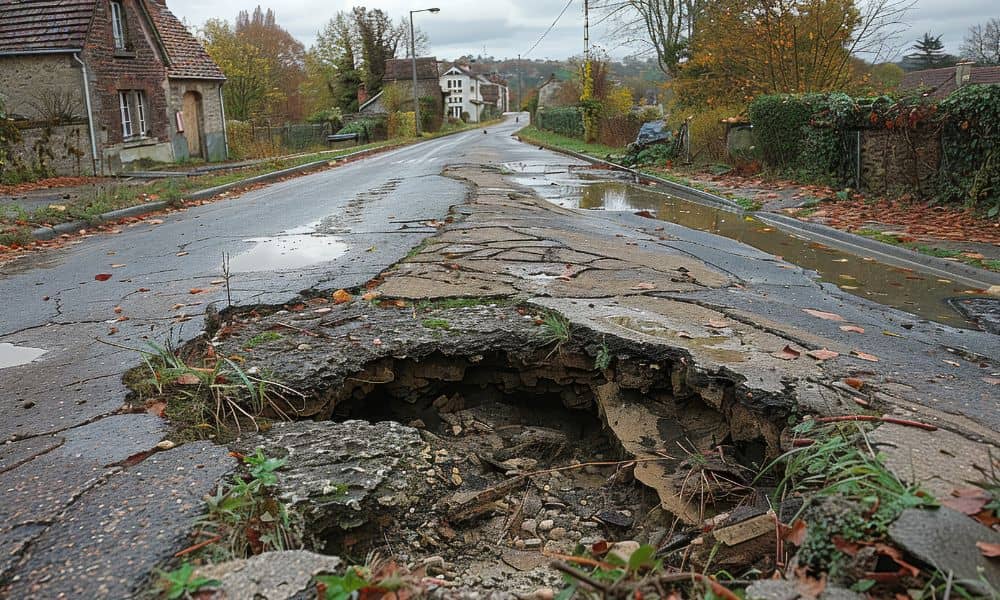
When a huge sinkhole opened up on a busy road in Bangkok, the world watched in shock. Cars dropped. Utility poles leaned. The road collapsed like it was made of paper. Videos of the incident spread fast, and many people wondered how something that dramatic could even happen. More importantly, it makes homeowners and builders in places like Charlotte ask a serious question: Could this ever happen here? The truth is that a disaster like that almost always begins with problems under the surface—problems that a topographic survey can reveal long before anyone starts to build.
Although Charlotte is far from Thailand, the lesson is the same everywhere. When we don’t fully understand the land, we take risks without realizing it. And while we may not see sinkholes as massive as Bangkok’s, smaller collapses, severe erosion, and foundation failures can happen if the land isn’t mapped correctly. That’s why a topographic survey plays such a critical role in protecting homes, roads, and future construction.
The Viral Bangkok Sinkhole: What Actually Went Wrong
The Bangkok collapse didn’t happen out of nowhere. Underground tunnel construction loosened soil layers. Stormwater systems failed. Water flowed into spots where it shouldn’t have. Over time, the ground weakened until it finally gave out.
This type of failure can look sudden, yet the warning signs were probably there. Soil shifts. Drainage issues. Ground settling. These problems build up slowly, and without proper mapping or regular checks, no one notices until it’s too late.
Sinkholes may feel like something that only happens overseas, but land can behave the same way anywhere. Charlotte has its own mix of clay-heavy soil, steep slopes, and flood-prone creeks. When you add ongoing construction, basement digs, and stormwater changes, the ground can shift in ways most people never see.
Could Something Like This Happen in Charlotte?
Charlotte is growing fast. New subdivisions, wider roads, and backyard additions all change how the ground carries weight. And while we don’t have giant subway tunnels like Bangkok, we do have:
- Strong storms that dump heavy rain
- Neighborhoods with steep grade changes
- Creekside communities with soft soil
- Old drainage systems that no longer keep up
- Rapid development that reshapes the land
Because of all that, small collapses and erosion issues happen more often than people think. Home foundations crack. Retaining walls bow outward. Yards sink after rain. Driveways tilt. These are early warning signs that the ground isn’t behaving well.
The good news? Most of these issues can be detected early with the right survey.
How a Topographic Survey Helps Prevent Ground Problems

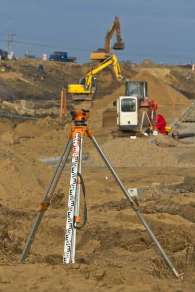
A topographic survey looks at more than just the outline of a property. It maps the shape of the land, the slope, the high and low spots, and the way water naturally flows. When a surveyor walks a site, they collect detailed elevation points that show how the ground behaves.
Once the data is processed, you get a clear picture of the land. And that picture helps engineers design a site that handles water correctly, avoids unstable soil, and places structures in safe zones.
Here’s what a topographic survey reveals that most people never notice:
- Hidden low spots where water may settle
- Steep slopes that can’t hold heavy structures
- Areas prone to erosion
- Drainage paths water follows during storms
- Man-made changes that affect stability
- Ground that shifts more than it should
Because it displays the land in three dimensions, not just two, it becomes the first warning system for problems that may lead to collapses or sinkholes.
And unlike a standard boundary survey, this one focuses on the behavior of the land, not just its edges.
Charlotte Has Rules That Rely on Accurate Topography
Charlotte’s rapid growth means that the city uses strict rules to manage stormwater and grading. Before building a home, adding a basement, or even placing a retaining wall, the city often requires detailed elevation data.
Many areas—especially near Little Sugar Creek, Briar Creek, McAlpine Creek, and Irwin Creek—sit close to flood zones. In these neighborhoods, even small mistakes in grading can push water toward a foundation or cause the soil to weaken.
A topographic survey provides the elevation numbers needed for:
- Floodplain checks
- Drainage design
- Foundation planning
- Soil evaluations
- Retaining wall placement
Without accurate topography, an engineer can’t design a safe site. And when water moves where it shouldn’t, the ground shifts, the soil loosens, and the risk of collapse grows.
Why Homeowners Should Care (Even If They Aren’t Building)
Even if you’re not planning a major project, the land around your home can still change over time. New construction uphill can redirect water toward your yard. A neighbor’s grading job can shift drainage lines. Heavy rains can wash away more soil each year.
Suddenly you notice:
- A small dip forming in the yard
- Water sitting after storms
- Cracks appearing in the driveway or walkway
- Gaps between the soil and your foundation
These aren’t random issues. They’re the land’s way of telling you that something is off. A topographic survey helps you understand what changed and how to fix it safely before the problem grows.
A Realistic Example Charlotte Residents Understand
Picture a new home being built two lots away. The builders cut into a hill to create a driveway. The soil above shifts. Rain pushes loose dirt downhill. Water now flows faster toward your yard.
At first, it seems harmless. But after one heavy storm, your yard dips. A small hole opens up. Then another rainstorm hits, and that tiny dip becomes a wider soft spot. If no one checks it and water keeps flowing there, the soil beneath may wash out over time—very similar to what triggered Bangkok’s collapse, just on a smaller scale.
This is how problems begin: slowly, silently, and out of sight.
Could a Bangkok-Style Sinkhole Really Happen Here?
A massive collapse like the one in Bangkok is unlikely, but ground failures can still happen in Charlotte when water, soil, and construction mix the wrong way. Every sinkhole, big or small, starts the same: the land weakens because no one understood it well enough before construction began.
That’s why topographic surveys matter so much. They’re the first step toward a safe home, a safe neighborhood, and a stable building site.
Final Thoughts
Charlotte’s landscape is beautiful, but it’s also complex. The mix of clay soil, slopes, stormwater systems, and rapid development means the ground can change faster than people notice. A topographic survey helps you understand the land beneath your feet before you build—or before small issues turn into serious damage.
If you’re planning a project or noticing changes in your yard, now is the right time to take a closer look at your land. A simple survey today can prevent big, expensive problems later.


