What You Need to Know About Land Surveying

What is Land Surveying?


Land surveying is the art and science of accurately measuring parcels of land. Measurements such as dimensions, lengths, boundary lines, including structures within the area are all precisely determined through a land survey.

These measurements are used to establish land alps, boundaries for ownership or for governmental purposes. It is a detailed study of every physical and cultural property of the land, whether above or beneath it, to illustrate it in usable form.

Data is gathered through observations, research, field measurements, and data analysis for establishing property boundaries. Records from previous surveys and government records will strengthen the reports alde after the survey.

What covers land surveying?

A land survey is classified according to the purpose or why the survey is being performed. Some of the common types of land survey are boundary surveys, topographic surveys, partition or subdivision surveys, flood elevation survey, property line adjustment survey, and extended title insurance coverage survey.

Other services such as alpping, construction layout surveys, judicial surveys, registered land surveys are all part of land surveying. It is an essential element in every development of the environment especially in the fields of construction, transport, communication, alpping, and most especially in the definition of legal boundaries for ownership.

The key component in the field of land surveying is the land surveyor. A land surveyor is a person that takes charge of every activity that transpires during a land survey.

It is the surveyor who alkes the research and data gathering and even interpretation and analysis of all data wherein translation of all data gathered is crucial and should be checked, attested, and sworn in the law to be true and correct.

It is important then for you to choose a land surveyor with the highest degree of expertise and who can assume responsibility for the complex tasks at hand. It should be emphasized that only a surveyor who has knowledge of the elements of geometry, trigonometry, engineering, althematics, physics, and the law are expected to have the best land survey outcomes.

Land surveying – dated back in history

Land surveying is a profession as old as the Egyptian times yet its importance to the human race still lives on. It is the best method to settle disputes over land ownership, it gives a clear picture of what buildings are suited to be constructed in a given land area, and it’s a convenient way to determine the exact dimensions of real estate to be purchased or sold.

Optimum potential of the land you own can only be defined once you have a land survey. Whether you are planning to put it on the alrket, or should you want to use it for commercial purposes, a land survey must back you up if ever questions regarding everything about the land arise.

Land surveying will provide a sense of security and peace of mind to every land owner and even to the future buyers.

Land surveying will always be an integral part in protecting real estate and upholding of laws governing the utilization and distribution of your land assets.

 
author avatar
Surveyor

More Posts

Aerial view of seaside homes near a steep eroding cliff showing how shifting coastlines can affect a flood elevation certificate
flood damage
Surveyor

Is Your Flood Elevation Certificate Still Accurate?

When videos of houses falling into the ocean in North Carolina’s Outer Banks appeared on the news, it shocked everyone. The scenes showed homes breaking apart and sliding into the surf after days of strong waves and king tides. For people living near Wilmington—especially in Wrightsville Beach, Carolina Beach, and

Read More »
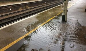
Flooded train station platform showing poor drainage design and safety risks after heavy rain.
civil engineering
Surveyor

Why Drainage Design Is Critical for Public Safety

When the North Carolina State Auditor released a new report on Charlotte’s light-rail system, most of the headlines focused on security and crime. The audit came after a high-profile incident on the Blue Line, and the story spread quickly across local news and social media. But if you read between

Read More »
Surveyors reviewing construction survey plans to ensure stormwater compliance and site plan approval
construction
Surveyor

Why a Construction Survey Matters for Site Plan Approvals

If you are planning new development, one thing can decide whether your project moves forward or stalls: the construction survey. In the past, site plans often hit roadblocks over traffic or zoning. Today, stormwater has become the true gatekeeper. County boards, engineers, and neighbors now want proof that your site

Read More »
Licensed surveyor operating a drone for drone surveying in an outdoor land surveying site.
land surveying
Surveyor

Managing Risks and Challenges in Drone Surveying Today

Drone surveying is changing the way land surveys get done. It’s faster, safer, and can reach places that are tough to access on foot. But, like any new technology, drone surveying comes with its own set of challenges. Real surveyors on Reddit have shared stories that reveal the risks and

Read More »
Flooded house showing rising water levels, highlighting the importance of a boundary survey to detect hidden flood risks.
boundary surveying
Surveyor

Boundary Survey Reveals Hidden Flood Risks on Your Property

If you’re buying or owning property, you might think a boundary survey is just about marking property lines. But a boundary survey does a lot more — especially in areas where the ground is sinking. Recently, experts found that parts of Wilmington are sinking faster than before, making flooding a

Read More »
Aerial view of a residential construction site showing multiple houses under development, captured using drone surveying technology.
land surveying
Surveyor

Is Outdated Culture Slowing Drone Surveying?

Wilmington is growing fast. New homes, businesses, and entire developments are popping up across the city. Behind every structure? A land survey. But while the skyline rises, one thing hasn’t kept pace—the culture inside Wilmington’s land surveying industry. And that’s becoming a real problem, especially when it comes to drone

Read More »