
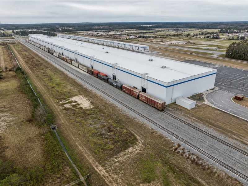
A rail spur can make an industrial site far more valuable. It also makes the site harder to plan. Tracks, embankments, loading docks, and ditches all have to work together, and small grade errors can keep a railcar from reaching the door.
Aerial surveying gives planners a fast look at the whole site, track and all. Drones or aircraft capture images and laser data across wide areas with fewer crews near active rail lines. That data helps developers, engineers, and site selectors see what fits before they spend money on design.
Aerial Surveying Coverage Across Rail Corridors and Industrial Parcels
Rail-served sites are often long and narrow. They can stretch along a main line for thousands of feet, with several parcels in between. Covering that ground on foot takes time, and much of it may sit on railroad property.
A flight can capture the parcel, the spur, and nearby roads in one pass. Crews set ground control points, which are marked targets with known positions, so the data lines up with real coordinates. Some ground work is still needed to check accuracy and pick up details the air can’t see.
Railroads usually have their own rules for crews working on or near their tracks. Flights over rail property may also need permission. Ask the railroad about access and safety rules early, since approvals can take time.
Trackside Elevations and Existing Rail Spur Connections
Track has to be close to level for railcars to roll safely and stop where they should. That makes elevation data along the rails very important. Designers need the top of rail, which is the running surface of the track, at many points along the spur.
Aerial data can show the general shape of the track bed, ballast, and switches. LiDAR, a laser scanner carried by the aircraft, helps capture elevations along the rails. Many projects still add ground shots at key points, such as switches and tie-in spots, to confirm the numbers.
Look closely at where a new spur would join existing track. The connection point affects grades, curves, and how much new track is needed. The railroad will often review that design, so get its standards before the layout is drawn.
Freight Loading Zones and Clearance Around Industrial Structures
Loading areas are where trucks, railcars, and forklifts meet. Each one needs space to work without hitting the others. Tight areas slow down shipping and raise the risk of damage.
Aerial data shows building edges, dock doors, canopies, fences, and light poles near the track. Designers use it to check the space between railcars and nearby structures. Clearance rules can come from the railroad, the state, and the project’s own standards, so confirm which ones apply.
Overhead items matter too. Wires, pipe racks, and conveyor bridges can block taller cars. LiDAR often captures thin overhead items better than photo mapping, so ask which method fits your site.
Drainage Channels and Terrain Constraints Near Rail Embankments
Water and track don’t mix well. Poor drainage can soften the ground under the rails and cause track to settle or shift. Embankments, ditches, and culverts all help keep the track bed dry.
An aerial surface model shows the shape of the ground across the site. Engineers use it to find ditch lines, low spots, and places where runoff heads toward the track. It also shows steep banks that may need extra fill or retaining walls.
The surface model won’t show pipe sizes or what’s inside a culvert. Field checks fill those gaps. If part of the site sits near a stream or in a mapped flood zone, permit reviews may ask for more data, and those rules vary by project and agency.
Aerial Surveying Data for Future Track and Yard Expansion
Many industrial users plan for growth from day one. A site may start with one spur and add more track, storage, or a bigger building later. Planning for that now can save a lot of rework.
The data from the first flight becomes a base map for future phases. Designers can test where added track might fit and how much grading it would take. They can also see where wetlands, slopes, or property lines may limit growth.
Keep the files in a format your team can reuse, such as CAD or a surface model. Note the flight date and the coordinate system used. When it’s time to expand, a new flight can be compared to the old one to show what changed.
Frequently Asked Questions
Can drones fly over active rail lines?
Sometimes, but it takes planning. Pilots must follow FAA rules for commercial flights. Railroads may also have their own rules for flights over their property. Get permission before any flight near the tracks.
How accurate is aerial data for rail design?
It can be very accurate when ground control and checks are used. Rail work often needs tight elevation data near the track. Many surveyors add ground shots at switches and tie-ins to confirm results. Ask your surveyor what accuracy to expect for your site.
Is LiDAR better than photos for rail sites?
Each one has strengths. Photo mapping gives a clear aerial image and a good surface model in open areas. LiDAR does better with thin objects and with ground under some trees. Some projects use both to cover the gaps.
Does aerial data show property lines?
No, aerial data doesn’t show legal property lines by itself. Boundaries come from deeds, plats, and a licensed surveyor’s field work. Aerial maps can be paired with a boundary survey for a full picture. That’s especially helpful when parcels border railroad land.
When should aerial work start on a rail-served project?
Start during site selection or early due diligence. The data helps you judge cost and fit before you buy or design. Railroad access approvals can take extra time. Building that into the schedule helps you avoid delays later.


