Land Surveying: Ethics of a Land Surveyor

land surveyorNot a lot of people realize that land surveying is actually a fusion of art and science. Yes, different equipment is available for the surveyor’s use, but the land surveyor still has the last say on the results.

Despite this though, a land surveyor still has several guidelines to follow. If you’ve had an experience with a dishonest surveyor, or are wary about hiring one, this article should be able to help you out.

What ethics should a land surveyor have?

A surveyor should always start a project with fairness in mind. Your client as well as everybody party involved in the project is expecting you to be fair and just so make the best possible assessment with the evidences handed to you.

Before a project commences, the surveyor assigned to the project should come forward if there’s a possibility of conflict of interest. This is very important to preserve their relationship with the client. A surveyor should avoid professional impropriety by declaring involvement or any prior affiliations with any of the involved parties. It is also the surveyor’s responsibility to keep any information regarding the project as well as the client confidential even after the project is done.

Several cases were reported where the surveyor overcharged the client. This usually happens when the client doesn’t know anything about land surveying. A land surveyor running his business with ethics will never do this. Fortunately, there are more honest land surveyors than dishonest ones.

A surveyor should charge a project according to the length of time needed to get it done as well as the level of technical complexity required for it. For the surveyor’s sake as well as the client, one should never sign plans, certificates or reports unless these are personally supervised by him. Not only is this unfair on the client’s side, doing so could put his reputation in danger should the results get disputed and he doesn’t know anything about them.

Just like with other industries, a land surveyor should never undermine the capability of other surveyors or the people from the land surveying industry.

New technologies come up for land surveying all the time. When a surveyor knows that a project is beyond his skills, he should tell the client about it. There’s no sense accepting a project only to come up with a subpar result. It will only hurt your business and your reputation.

Surveyors should also be responsible enough to study, do a thorough research, practice and utilize his skills before offering clients a new service. If a surveyor is new to flood determination, for instance, then he needs to make sure that he knows how to perform it before offering it to his clients.

Surveyors do not work alone. They usually have a staff to support them. The land surveyor needs to be responsible for their actions at all cost, for actions or work carried out by them.


author avatar
Surveyor

More Posts

Office building and driveway at an existing commercial property, illustrating the site conditions considered in ALTA survey requirements
alta survey
Surveyor

ALTA Survey Planning for Office-to-Residential Conversions

An office building headed for apartments still sits on the same land. It has the same boundary lines and the same easements it had as an office. Before architects start drawing units, the lender and title company usually want a clear record of that property as it stands today. That

Read More »
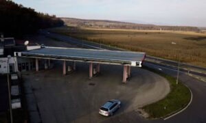
Fuel station with a large canopy and road access, an example of property considered in an ALTA land title survey
alta survey
Surveyor

ALTA Land Title Survey Planning for Fuel Station Properties

Fuel station deals tend to move fast, and the survey often gets ordered after both sides have already signed the purchase contract. That timing causes trouble on a small lot packed with pumps, a canopy, buried tanks and driveways that open onto busy roads. An ALTA land title survey gives

Read More »
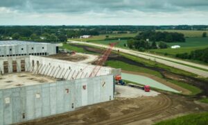
Tilt-up warehouse construction site with concrete wall panels and crane for construction survey
construction
Surveyor

Construction Survey Coordination for Tilt-Up Warehouse Layouts

A tilt-up warehouse moves fast once the floor slab goes in. Crews form the concrete wall panels right on the slab, lift them with a crane and set them on footings that someone laid out weeks earlier. When the construction survey information behind those steps doesn’t match, the problem tends

Read More »
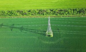
Aerial view of a transmission tower and power lines crossing farmland, illustrating how LiDAR mapping can support transmission corridor planning
drone surveying
Surveyor

LiDAR Mapping for Electric Transmission Corridor Planning

A new transmission line can cross miles of farmland, woods, creeks, roads and private property before it reaches a substation. The people planning that line need a clear picture of the ground along every mile, and they need it early. LiDAR mapping gives them that picture before field crews walk

Read More »
Rural property with a house, detached barns, driveway, and surrounding land for lot survey planning
land surveying
Surveyor

Lot Survey Planning for Detached Workshop Placement

A detached workshop sounds easy to plan. Pick a flat, open spot. Pour a slab. Start building. But the spot that looks best from your porch is not always the spot that will work once you check the property lines, easements, and ground conditions underneath the grass. For property owners,

Read More »
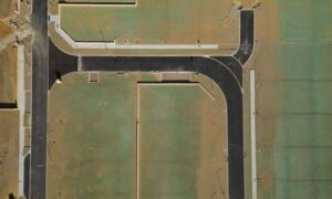
Aerial view of residential lots and roads showing the property layout for a mortgage survey
land surveying
Surveyor

Mortgage Survey Planning for Modular Home Financing

If you are financing a modular home, your lender will likely ask for a mortgage survey before closing. This is not the same as a full boundary survey. It is not paperwork you can skip and add later either. It shows where the home sits, or will sit, on the

Read More »