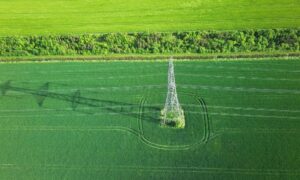
A new transmission line can cross miles of farmland, woods, creeks, roads and private property before it reaches a substation. The people planning that line need a clear picture of the ground along every mile, and they need it early. LiDAR mapping gives them that picture before field crews walk the route.
LiDAR stands for light detection and ranging. A sensor on an airplane, helicopter or drone sends out laser pulses and records how long each one takes to bounce back. The result is a dense 3D set of points that shows ground shape, trees, buildings and existing power lines. Engineers and surveyors can study long stretches of land from the office and then send crews to the spots that need a closer look.
Charlotte sits near the center of this work. Duke Energy has its headquarters here, and on September 24, 2026, the U.S. Department of Energy announced it had picked the company for $50 million in funding for transmission technology upgrades in the Carolinas. Projects like that one keep corridor mapping and survey planning in steady demand across North Carolina.
Using LiDAR Mapping to Compare Potential Transmission Routes
LiDAR mapping lets a project team place several route options on the same ground model and compare them side by side. Each option gets measured against the same data, so the comparison stays fair. A route that looks short on an aerial photo can turn out to cross two ravines and a thick stand of hardwoods.
Teams often compare routes on factors like these:
- Total length and the number of turns in the line
- Road, rail and water crossings
- Tree height and density inside the planned clearing width
- Distance to homes, barns and other buildings
- Chances to run beside an existing line or road
Turns matter because angle points in a line often need heavier structures than straight runs. Tree data matters because every route needs a cleared strip, and LiDAR shows how tall the trees are along each option. Some new lines in North Carolina also need approval from the North Carolina Utilities Commission, so a clear record of how each route was compared can help later.
Finding Terrain Constraints Along Long Utility Corridors
LiDAR can produce a bare-earth surface, which is a model of the ground with trees and buildings removed. That surface shows slopes, drainage paths and low spots along the entire corridor. Engineers use it to decide where structures can stand and how crews will reach them.
The rolling hills and many creeks around the Charlotte region make this step worth the effort. A structure placed on a hilltop may allow a long span across a valley. A structure placed at the bottom of a draw may sit in wet ground and need a different foundation.
Access is the other half of the terrain question. Cranes, bucket trucks and concrete trucks need routes they can climb. LiDAR contours help planners spot grades that are too steep and find gentler paths before anyone builds a temporary road.
Identifying Critical Areas That Need Closer Field Verification
LiDAR narrows the field work, but it doesn’t replace it. The data points to the places where a crew should go and measure on the ground. Planning those visits from the map saves days of walking open pasture that needs little attention.
Road and rail crossings usually top the list. The owners of those crossings may ask for detailed survey data before they approve a line over their property. Stream crossings and possible wetlands also need field work, and qualified environmental specialists typically set wetland limits.
Some things LiDAR can’t show well or at all. Buried pipes and cables don’t appear in the data. Dense evergreens can block enough pulses that the ground model gets thin in spots. Survey crews also measure ground control points and check shots so the team can confirm how well the LiDAR matches real conditions.
Coordinating LiDAR Data With Boundary and Easement Work
LiDAR shows the land, but it doesn’t show who owns it. Property lines come from deeds, recorded plats and physical evidence like iron pins and monuments found in the field. County GIS parcel lines give a quick first look, but they aren’t survey-grade and can be off by several feet or more.
Once a route settles, surveyors research each parcel the line crosses. They look for existing easements from pipelines, other utilities and shared driveways. They then prepare easement descriptions and exhibits that show where the new strip falls on each property.
This work goes smoother when everyone uses the same coordinate system. In North Carolina, that is usually the North Carolina State Plane system. When the LiDAR model, parcel lines and easement strips all sit on the same grid, a landowner can see exactly how close the corridor comes to a house or well. North Carolina law under Chapter 89C reserves boundary survey work for licensed professional land surveyors.
Planning Survey Scope as North Carolina Grid Investment Expands
Survey scope depends a lot on whether a project builds a new corridor or upgrades an existing one. The DOE-funded project focuses on technologies such as advanced conductors and dynamic line ratings that add capacity to lines already in place. Upgrades like these may need less new land, but they still call for current data on existing structures, wire heights and right-of-way limits.
New corridors ask more of the survey team. Route studies, parcel research, easement exhibits and crossing surveys all come into play. The number of parcels alone can shape the schedule.
A few scope questions are worth settling early:
The team should agree on how precise the data needs to be at each phase, since a route study needs less than final design. Flight timing matters too. Leaf-off months in winter let more pulses reach the ground in hardwood forests, while pine stands change less with the seasons. File formats, coordinate systems and the list of field checks should match what the design engineers expect. Requirements can vary by utility, permitting agency and project, so confirm them with your surveyor before flights get scheduled.