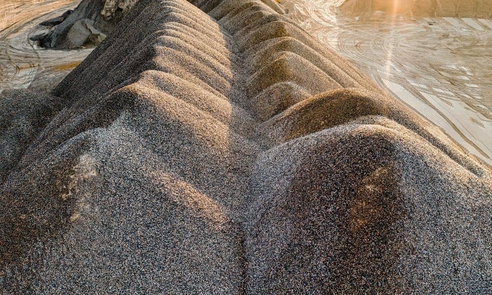
Measuring a stockpile by hand is slow. It also means someone has to climb the pile, and that pile can shift under their feet. Aggregate producers near Charlotte need a fast, safe way to know how much material sits in each pile. An unmanned aerial system survey does this job well. A drone flies over the stockpile and captures its shape in detail. The quarry gets accurate volume numbers, and no one has to climb anything.
This kind of survey has become a common tool at quarries. It helps track inventory, plan future digging, and support property deals tied to aggregate sites.
Stockpile Mapping Needs Across Piedmont Aggregate Operations
Stockpile mapping tells a quarry how much material it has on hand. That number feeds into daily planning. It also feeds into royalty and tax reports, and decisions about when to move more material.
The Piedmont region around Charlotte has long produced crushed stone and other aggregate. This material feeds local roads and building projects. As building activity keeps up in this area, quarries need a fast way to track output without slowing down their work.
Old measuring methods struggle with stockpiles. Piles are rarely smooth or even. They have high points, low points, and rough edges that a few tape measurements can’t capture. Walking on a pile is also risky, since loose or wet material can shift fast.
A drone survey solves both problems. It captures the whole pile from above in one flight. No one has to stand on shaky ground to get the numbers.
Planning an Unmanned Aerial System Survey at a Quarry
Good planning starts with knowing how the site runs each day. A quarry stays busy. Trucks move, machines run, and material gets added or removed on a set schedule. The flight needs to happen at a time that captures good data without getting in the way of that work.
Anyone flying a drone for this kind of job must follow FAA Part 107 rules. These rules cover pilot training, airspace, and safe flying. A quarry with tall machines, power lines, or nearby buildings adds more things to check before takeoff.
Dust is another factor to plan around. Active quarries kick up dust that can blur photos. Flight timing often depends on recent digging and the weather that day. Light matters too. Shadows and glare can hide parts of the pile’s surface in photo based surveys.
The type of sensor used depends on the site and the goal. Some surveys use sharp photos turned into a 3D model. Others use a laser based sensor that can still work well in dusty air. Either method can build a useful stockpile model when the flight fits the site’s real conditions.
Establishing Control for Repeatable Stockpile Surface Data
A stockpile survey only helps if the numbers can be trusted and compared over time. That starts with control points. These are fixed spots on the ground with a known, checked location. Every measurement from the flight ties back to these points.
A surveyor sets up control using ground points or GPS methods tied to a known survey network. In North Carolina, this kind of work must be done by a licensed surveyor. State law says only licensed professionals can perform official land surveying.
Solid control matters most when a quarry flies the same piles more than once. Say a producer wants to track how volume changes each month for a report. Each flight needs to use the same control points and the same reference system. Without that match, any change between two surveys might just be measuring error, not a real change in the pile.
Calculating Volumes From Stockpile and Base Surfaces
Volume comes from comparing two surfaces. The flight captures the top of the pile in fine detail, showing every rise, dip, and edge. That top surface then gets compared to a base surface. The base is the ground or reference level the pile sits on.
The drone can only see what’s visible from above. It can’t measure material through the pile. So the base surface has to come from another source. This might be ground data recorded before the pile was built, or a known reference level the quarry has used before.
A typical volume report includes:
- The top surface captured during the flight
- The base or reference surface used for comparison
- The final volume number between the two surfaces
- The control points and reference system used
Getting the base surface right often makes the biggest difference. A wrong base can throw the volume number off by a lot. This is one of the first things worth checking with whoever processes the data.
Delivering Quarry Data for Planning and Due Diligence
The final package usually includes a volume report, a digital model of the surface, and updated maps showing where each pile sits. This data supports several needs at once.
For daily work, it helps with production planning, inventory checks, and reports tied to material sold or dug up. For long term planning, it shows operators how much material is left and how fast it’s being used.
The same data can help with a property deal too. If someone is buying, selling, or refinancing a quarry, recent stockpile data shows current inventory and site conditions before the deal closes. As with any survey used in a deal, it’s worth checking early with the surveyor, lender, or title company on what level of detail the deal needs.