If you’re buying or owning property, you might think a boundary survey is just about marking property lines. But a boundary survey does a lot more — especially in areas where the ground is sinking. Recently, experts found that parts of Wilmington are sinking faster than before, making flooding a bigger problem for many neighborhoods. This means your property might be at risk, even if you don’t see it yet. A boundary survey can help reveal these hidden flood risks, saving you money and trouble down the road.
What Is a Boundary Survey, Really?
You might have heard of a boundary survey as the process of checking where your property lines are. That’s true. But it also involves measuring the exact size, shape, and elevation of your land. Surveyors use special tools to map out your property and its features, like fences, buildings, and natural elements.
In Wilmington, where the land is sinking slowly, those measurements are even more important. Because as the ground shifts, your property lines and elevations might change too. That can affect whether your property is in a flood zone or not — and that’s where the hidden flood risks come in.
Why Is Wilmington Sinking?
Wilmington sits near the coast, so it’s no surprise that it’s affected by rising sea levels and flooding. But there’s another problem called land subsidence, which means the ground is sinking. This happens when soil compacts or settles over time, or when underground water is removed.
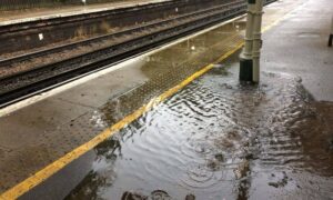
A new study found that land subsidence is making flooding worse. High tides now reach places they didn’t before, and more homes and businesses face flood damage. This change isn’t always obvious from the street, which is why a boundary survey can provide critical information.
How a Boundary Survey Detects Hidden Flood Risks
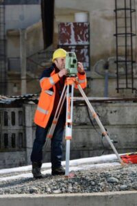
When a surveyor conducts a boundary survey, they don’t just mark corners. They also measure the land’s elevation — how high or low the ground is compared to sea level. This is key because small changes in elevation can decide if your property floods or stays dry.
A boundary survey can show if parts of your property have sunk into a floodplain or if nearby drainage paths have shifted. It can also reveal if structures like sheds or fences now sit too close to areas at risk of flooding. With this information, you can get an elevation certificate, which lenders and insurance companies often require.
Why This Matters When Buying or Refinancing Property
If you’re planning to buy a home or refinance a mortgage, a boundary survey can protect you from surprises. Flood zones are updated regularly, especially in areas affected by subsidence. Without a recent survey, you might unknowingly buy a property that faces higher flood risks than before.
Lenders often require surveys during the loan closing process. A boundary survey that includes flood risk assessment helps ensure you’re not caught off guard by new regulations or insurance costs. In some cases, knowing about flood risks early can influence your buying decision or how you prepare your property.
How a Boundary Survey Helps Developers and Builders
Builders and developers also rely on boundary surveys to avoid costly mistakes. If the land is sinking, construction plans need to account for changes in elevation and flood zones. Otherwise, structures might be built where flooding is likely, causing damage and legal trouble.
Surveyors can help identify safe building areas and recommend adjustments to designs. This keeps projects on track and helps communities stay safer as environmental conditions change.
What to Expect from a Boundary Survey
When you hire a licensed land surveyor, they’ll visit your property with advanced equipment, including GPS and sometimes drones. These tools capture precise measurements of your land’s boundaries and elevation.
The surveyor will compare this data to flood maps, zoning rules, and previous surveys. They’ll create a detailed report showing where your property lines are and if any parts are at flood risk. You’ll also receive a clear map you can use for insurance, permits, or future planning.
Taking Action: Protect Your Property Today
Wilmington’s land is changing, and flood risks are growing. A boundary survey is more than just a formality—it’s a smart step to protect your investment. Whether you’re buying, selling, refinancing, or planning construction, knowing your property’s exact boundaries and elevation can save you thousands in repairs, fines, and insurance costs.
If you haven’t had a boundary survey recently, now is the time. Talk to a licensed land surveyor familiar with unique challenges. They’ll help you understand your property’s risks and guide you toward smart decisions.
Final Thoughts
The ground beneath many neighborhoods is shifting, which can bring unexpected flood risks to property owners. A boundary survey helps reveal these risks by carefully mapping your property lines and elevation. Taking this step can give homeowners, buyers, and developers valuable insight to avoid surprises later on.
If you haven’t had a recent survey, it might be a good idea to talk to licensed land surveying experts. These professionals understand the challenges that come with changing landscapes and can help you better understand your property, bringing peace of mind as conditions evolve.
