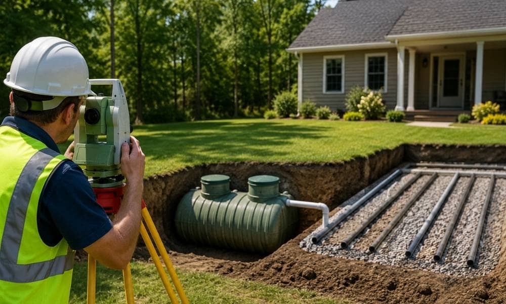
Most developers focus on zoning, utilities, and road access when evaluating a property. Septic systems rarely come up until something goes wrong. That is when costs spike, timelines shift, and deals fall apart. A residential land surveyor can catch these problems before they become expensive. Here is what the survey process actually reveals, and why it matters before you break ground.
How a Residential Land Surveyor Identifies Existing Septic System Locations
Rural properties often have septic systems that are decades old. Tanks, drain fields, and reserve areas are rarely visible from a standard walkthrough. Older systems may have no clear markers. Some were installed before accurate records were required.
A residential land surveyor reviews deed history, county records, and on-site conditions to locate these components. They document what is there and where it sits on the property. That information goes into a survey map you can actually use.
Why does this matter for developers? Because building on or near a septic system without knowing it is there creates serious problems. Permits get denied. Work stops. In some cases, systems get damaged and must be replaced. The cost to replace a septic system typically starts around $3,000 and can exceed $15,000 depending on soil conditions and system type.
Getting the survey done first avoids that situation entirely.
Why Property Improvements Can Conflict With Septic System Areas
A garage, pool, or added square footage changes how you use a property. Each of those improvements also changes what can be built and where.
Septic tanks and drain fields require clearance from structures. In North Carolina, setback rules from the North Carolina Division of Public Health require septic tanks to be at least five feet from a structure. Drain fields typically require more. Building over or near those zones without checking first leads to redesigns, denied permits, and unexpected costs.
Survey data maps exactly where the existing septic components sit. You can overlay that information on your site plan before any drawings go to the county. If there is a conflict, you find out during planning instead of during construction.
This is one of the clearest ways survey work protects your budget on a development project.
Finding Hidden Property Constraints Around Septic Drain Fields
Properties outside city limits in North Carolina often carry restrictions that do not show up in a basic title search. Wells, drainage easements, utility corridors, and neighboring septic systems can all limit where a new drain field can go.
North Carolina rules require specific separation distances. A septic system must stay at least 50 feet from a well in most cases. It must stay away from streams, property lines, and drainage features. On smaller rural parcels, these requirements can leave very little room for a compliant installation.
A survey identifies where those constraints fall on your specific property. You get a clear picture of what is restricted and what is usable. That shapes site planning decisions before you submit anything to a permitting agency.
Without that data, you are guessing. And incorrect guesses on septic placement cost time and money to fix.
How Survey Data Supports Future Septic System Expansion Plans
Developers often plan for growth. A property that works today may need to support more units, an accessory dwelling, or a larger structure in a few years. When that happens, the existing septic system may not have enough capacity.
North Carolina requires a designated reserve area for most septic systems. That area must remain undisturbed so it can be used if the primary drain field fails or needs expansion. Many developers do not know where that reserve area sits until it has already been built over.
Survey data shows the reserve area location and its relationship to your planned improvements. You can design around it from the start rather than scrambling to find a compliant solution after a permit review catches the problem.
Long-term planning is easier when the property constraints are mapped accurately from the beginning.
Why Septic System Surprises Often Appear During Property Transfers
Sales, refinancing, estate transfers, and land divisions all trigger closer scrutiny of property records. That is when hidden septic issues surface. A system that was never properly permitted. A drain field that sits inside a utility easement. A reserve area that was built over years ago.
These issues do not just delay closings. They change deal terms. In some cases, they kill transactions.
Survey work brings these conflicts to light before they reach that stage. A residential land surveyor documents existing conditions and flags discrepancies between what is on record and what is actually on the ground. Lenders, buyers, and attorneys can all review that information with confidence.
If you are acquiring land at auction or buying without an inspection contingency, survey data is one of the few protections you have. It is not a substitute for a septic inspection, but it gives you the location and context you need to ask the right questions.